

Red Feather Trail Jamboree
Red Feather Lakes, CO • September 25, 2026
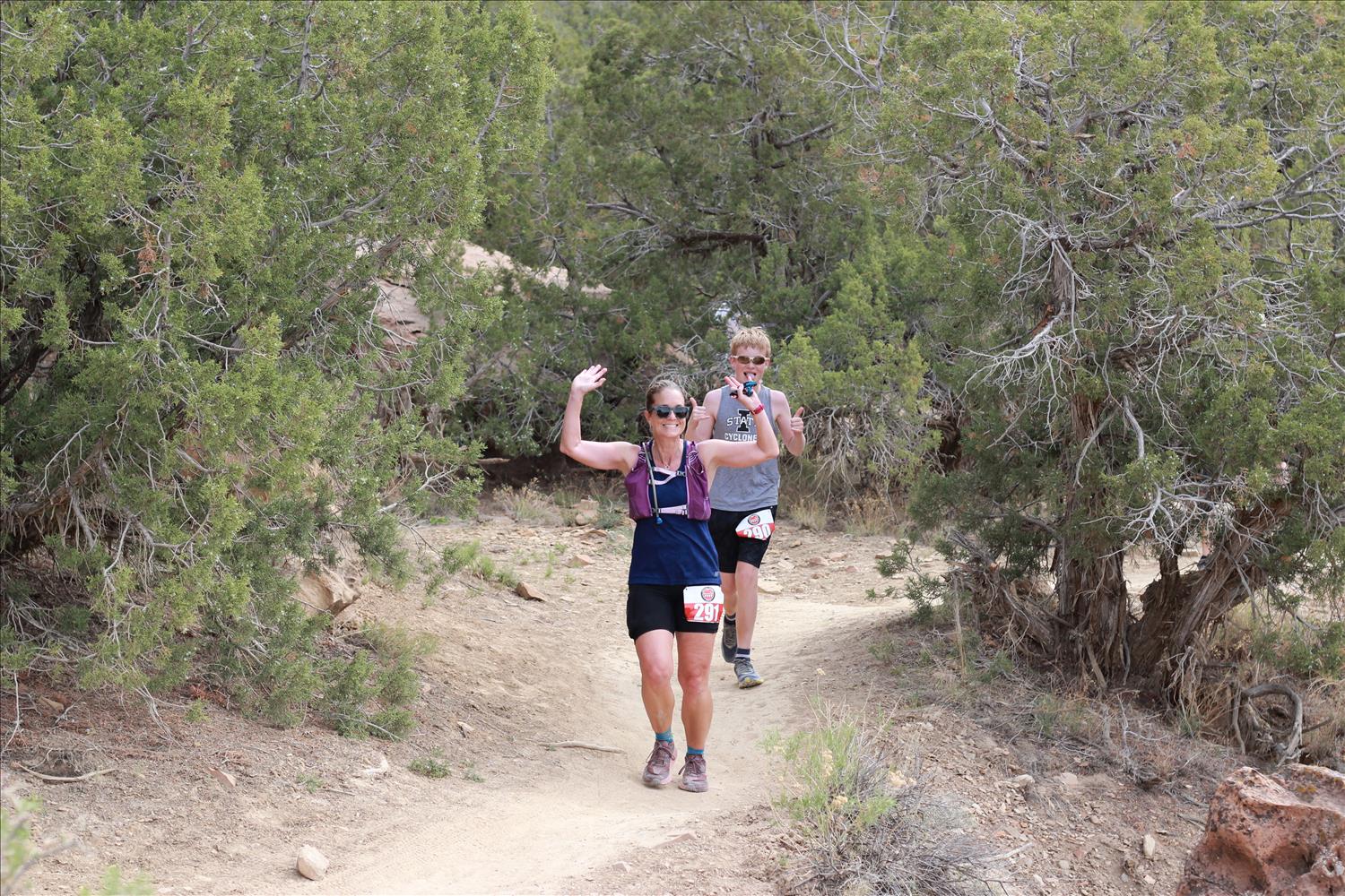
Welcome to the Red Feather Trail Jamboree, a three-day trail running weekend put on by trail runners for trail runners. Come enjoy the clean air and wild spaces of the Red Feather Lakes region in Northern Colorado! Take advantage of the opportunity to explore some new trails on the private land of the Ben Delatour Scout Camp and surrounding National Forest. These courses are especially designed to challenge you yet still be beginner friendly. With miles through moose-heavy forest and fields, streams and rocks, these race routes have something for everyone. Facilities include campgrounds and cabins for rent, community meals in the dining hall, and an on-site shower house. We want to make this a fun, family-friendly weekend outing for all! Run one event, run two or take on the 95 mile challenge and run all three!! Start: Ben Delatour Scout Ranch, Red Feather Lakes, ColoradoDistances: 50 Mile (8,500' gain), 50K (4,200' gain), Half Marathon (1,700' gain)Min/Max Elevations: 7,350' / 8,500' (50K/Half), 7,350' / 10,828' (50mi)Average Elevations: 8,700' (50mi), 7,800' (50K/Half)Terrain: 70-80% singletrack, 20-30% dirt roadFauna: Moose, raptors, elk, mule deer, black bears, mountain lionsRegistration Caps: 500 totalTime Allowance: 16 Hours (50Mi), 11 Hours (50K), 6 Hours (Half)Dates: September 25-27, 2026Start Times: Fri 6:00a (50mi), Sat 7:00a (50K), Sun 8:30a (Half Marathon)Kids Race:: FREE, 1mi, Sunday @ 11:30a Registration 50 Mile Race Fees:Dec 15 - April 30: $130 + $8.80 feeMay 1 - July 31: $150 + $10.00 feeAug 1 - Sept 24: $160 + $10.60 feePacket Pickup: $180 50K Race Fees:Dec 15 - April 30: $120 + $8.20 feeMay 1 - July 31: $140 + $9.40 feeAug 1 - Sept 24: $150 + $10.00 feePacket Pickup: $160 Half Marathon Race Fees:Dec 15 - April 30: $90 + $6.40 feeMay 1 - July 31: $100 + $7.00 feeAug 1 - Sept 24: $110 + $7.60 feePacket Pickup: $125 3-Day Challenge Race Fees:Dec 15 - April 30: $280 + $15 feeMay 1 - July 31: $300 + $16 feeAug 1 - Sept 24: $340 + $18 feePacket Pickup: $370 What You Get in Return for Your Registration Fee: Beautiful, well-marked and challenging coursesEnthusiastic, knowledgeable race and race staff & volunteersGender specific race T-shirtFinisher awardFree race photosFinish Line meal Vegetarian, vegan, gluten free and non-alcoholic options are available as part of our standard race fare Medical & emergency communications coverage Waiting List If the race fills, a waitlist will be established. If you are selected from the waitlist, you are given the opportunity to accept/decline the invitation. Your credit card will not be charged until you accept. Your fellow runners in line appreciate your prompt response. Transfer Credit & Distance Change Policy If you are not able to race, we will be able to offer a race transfer credit that can be applied to any future Gnar Runners race (valid for 12 months). Credit deadlines are as follows: Until April 30: 100% credit of registration (excluding RunSignup fees).May 1 - July 31: 75% credit of registration (excluding RunSignup fees).August 1 - September 22: 50% credit of registration (excluding RunSignup fees). **In order to receive your credit, you must cancel your registration through the RunSignup registration platform. Deferrals: Log in to your RunSignup accountGo to Profile -> Upcoming Races -> Red Feather Trail Jamboree -> Manage RegistrationAt the bottom of the page, select “Defer Registration” and follow the automated process.While RunSignup will prompt you to, you DO NOT have to immediately choose which race to apply your credit to. Once you hit "Confirm Deferral" and see the "Your registration has been deferred" message, your credit is in the system and will be valid for one year past the event date. Distance Switch: Log on to your RunSignup accountGo to Profile -> Upcoming Races -> Red Feather -> Manage RegistrationAt the top, click the link to "Transfer Event"Follow the steps to register for the race in the new distance Runners stepping up in distance can pay the additional registration fee to upgrade to the marathon race. There is no charge for runners dropping down in distance. The online deadline to transfer is Wednesday (9/24) at midnight. It can also be done in person at packet pickup. Cancellation Policy Entries are non-refundable. Entries are non-transferable, except for transfers via the wait list. In the event the race is cancelled due to extreme weather, fire, disease or for some other unforeseeable event, we cannot offer refunds or credits. Course & Aid Stations The 50K course will have approximately 4,200ft of vertical gain.The 50 Mile course will have approximately 8,500ft of vertical gain.The Half Marathon course will have approximately 1,700ft of vertical gain. Course Maps Course GPX File Red Feather Trail Jamboree 50 Mile GPX (Current for 2025)Red Feather Trail Jamboree 50K GPX (Current for 2025)Red Feather Trail Jamboree Half Marathon GPX (Current for 2025) Red Feather Trail Jamboree Camping Map Facility Map of the Ben Delatour Scout Camp Trail Map of the Ben Delatour Scout Camp Course Profiles Aid Stations - 50 Mile Aid StationMile SplitTotalGainDescentCut-OffGoodell4.84.8720800-Unmanned (Water Only)5.19.91400350-Baldy4.414.31400100-Deadman7.121.66001900-Baldy4.626.01500300-Granite Ridge6.432.440018004:30pElkhorn4.937.3350800-High Adventure7.344.6880810-Finish5.349.91150119010:00p Aid Stations - 50K Aid StationMile SplitTotalGainDescentCut-OffHigh Adventure5.35.311901150-Elkhorn7.312.6810880-Lady Moon6.619.2960790-Lady Moon6.725.9640640-Elkhorn2.728.6500270-Finish2.631.21604706:00p Aid Stations - Half Marathon Aid StationMile SplitTotalGainDescentCut-OffElkhorn2.62.626090-Lady Moon6.59.1960790-Elkhorn2.611.7390190-Finish2.614.3902802:30p All full service aid stations will stock the following items: Gnarly Fuel2O Nutrition sports drink.Water and iceSalty snacks: Pretzels, potato chips, corn chipsFruit: Oranges and Bananas plus additional variety depending on what might be availableSweets: Cookies, M&M's, Gummy bearsSoda: Coke, Ginger Ale ***There will be GF/Vegan alternatives for nearly all non-GF/V standard offerings. These are typically held back to save them for those who need them, so please ASK! Also note that while we will do our best to keep utensils and trays separated for these as well as common allergens, this is the backcountry and cross-contamination can occur. While we will provide plenty of electrolyte options in drink mix and salty real foods, we deem the risks associated with salt in concentrated pill form to be more than we're comfortable providing. We won't restrict runners from using their own salt caps, but will not have them available at aid stations. Time Cut-Offs The 50K and Half Marathon distances have no intermediate cut-off times. Anyone who completes the full course is recognized as a finisher. Recommended pace to finish: 50K: 21:20 min/miHalf: 22:50 min/mi The 50 Mile distance has one cut-off, which is in place to help ensure all runners are back on camp property before darkness falls, while still allowing all to achieve at least a 50K distance for the day: Granite Ridge Aid Station (Mile 32.4) at 4:30pm. 10:30 Total time (19:22min/mi). Drop Bags If you have any specific personal needs, drop bags will be allowed during the 50mi race at the Deadman (mile 21.6) and Granite Ridge (mile 32.4) aid stations. No drop bags for the 50K or Half Marathon. Drop Bags can be dropped off either at Thursday night's packet pickup or on Friday morning any time up until the race start. Please provide your own bag and keep it to a reasonable size (small duffel bag or stuff sack). Clearly label it with your name and bib number. Please do not leave any valuable items in your drop bags - volunteers are not responsible for lost items. Drop bags will not be returned to the start until each aid station shuts down and packs up at the end of the day (likely after sundown). If you finish early and need your drop bags before heading home, you are welcome to drive around to the aid stations to pick up your drop bag. Unclaimed bags will be transported to Altitude Running post-race, available in the race's lost & found box for two weeks before being donated. Course Marking The course will be well marked with pink flagging and pink pin flags. Important intersections will be supplemented with flour ground markings and directional arrows. On longer stretches of trail without intersections, confidence flagging will be placed approximately every quarter mile. Turns will be marked heavily. Toilets Restrooms are available at the Start/Finish as well as various locations around camp, the Elkhorn Trailhead/Aid, the Granite Ridge Trailhead/Aid and the Lady Moon Trailhead/Aid. All other aid stations will have trowels and TP. Crew Access Family and friends can meet their runners at the Elkhorn, Granite Ridge, North Lone Pine (Deadman) & Lady Moon Trailheads. Carpooling is highly recommended to limit traffic and parking congestion at the trailheads. All trails are open to the public, so family and friends are allowed to run, hike, or bike on the course; however, pacing or crewing outside designated aid stations is not allowed and will result in the disqualification of your runner. NO Crewing is allowed at the High Adventure, Goodell or Baldy Aid Stations. Driving Directions: Elkhorn Trailhead: From the Coral Rock Dining Hall Start/Finish, follow the main park road 1.2mi back out the main gate to CR68C (Boy Scout Road). Turn left (west) and go 2.0mi to the sign for the Elkhorn Trailhead. Turn right and follow the access road 0.2mi to the trailhead. Lady Moon Trailhead: From the Coral Rock Dining Hall Start/Finish, follow the main park road 1.2mi back out the main gate to CR68C (Boy Scout Road). Turn right (east) and go 2.3mi to CR74E (Red Feather Lakes Rd). Turn left (west) and go 4.0mi to the sign for the Lady Moon Trailhead. Turn left into the parking lot. Granite Ridge Trailhead: From the Coral Rock Dining Hall Start/Finish, follow the main park road 1.2mi back out the main gate to CR68C (Boy Scout Road). Turn left (west) and go 4.5mi to the 3-way junction with CR69 (Manhattan Rd). Turn right (north) and go 4.6mi to the sign for the Granite Ridge Trailhead. Turn right and follow the access road 0.2mi to the trailhead. North Lone Pine Trailhead (Deadman): From the Coral Rock Dining Hall Start/Finish, follow the main park road 1.2mi back out the main gate to CR68C (Boy Scout Road). Turn left (west) and go 4.5mi to the 3-way junction with CR69 (Manhattan Rd). Turn right (north) and go 6.7mi to CR74E (Red Feather Lakes Rd). Turn left (west) and go 0.2mi to the 3-way intersection, and take another left onto CR86 (Deadman Rd). Go 4.2mi to the sign for the North Lone Pine Trailhead, and take a left into the lot. Training There will likely be organized training runs in August/September for Red Feather, including a course preview & trail work weekend centered on Saturday/Sunday, August 16-17. See the Fort Collins Trail Runners Facebook Group for group run postings, as well as our Events Section of our Facebook page for more info. Detailed Course Directions - 50 Mile In addition to the Boy Scout, Elkhorn and Lady Moon trails enjoyed on parts of the 50km and half marathon courses, the 50 mile route takes in the Lone Pine and Killpecker trail systems within the Laramie Mountains. The route tops out just below 11,000 feet between Middle and North Bald Mountains, taking in sweeping views in all directions of the Mummy Range, the Never Summer Range and the Medicine Bow Mountains. The course offers a wonderful mix of terrain, from buttery Colorado singletrack to technical Red Feather hardscrabble with linkages on rugged Forest Service jeep tracks. The 50 mile course offers a full taste of the unique Red Feather Lakes landscape. Start to Goodell Aid Station (Mile 4.8): From the Coral Rock Dining Hall, head south on the main park road for about 0.3mi, to where the road has a Y-junction. To the left is the Gregg Boundary Trail. Stay straight / right on the road, passing through a gate onto a primitive road for about 0.2mi, crossing another gate, to a junction with a well-established jeep road (CR168 / Rim Rd). Turn right on CR168 and follow it west about 4mi as it rolls through forest and meadow along the ridge rim, finally descending sharply to the trailhead just off of CR69 / Manhattan Road and the aid station. Goodell Aid Station to Baldy Aid Station - 1st Visit (Mile 14.3): This will be your longest stretch between aid stations. From the CR168 trailhead, turn right (north) on CR69 and follow it a mile to Goodell Junction, a 3-way intersection with CR68C. Turn left and continue following CR69 north for another mile, up a couple mild switchbacks to the somewhat obscure turn onto CR171A. Turn left onto CR171A and follow this smooth jeep road roughly 3 miles to the Unmanned Aid Station (Water Only). There will be many side roads and pull-outs that will try to confuse you - keep watching for course markings! Tank up at the Unmanned, then cross the gate onto the Swamp Creek Trail, which winds gradually for 3mi uphill on rocky terrain as you enter the outer limits of the devastation caused by 2020's Cameron Peak fire. The Swamp Creek Trail will top out at an obscure 3-way intersection with FS517 and the Elkhorn-Baldy connector, as you enter the one mile of course today you'll see twice. Turn left (west) at this intersection and follow the road about a mile to the aid station, tucked in right where the trees become green again! Baldy Aid Station - 1st Visit to Deadman Aid Station (Mile 21.6): Say 'See You Later' to the Baldy aid crew - because you will! - and continue generally westward on the road (CR517) for a mile to its junction with Killpecker Road (FS300). Turn right for barely 100 yards, then right again on to the Killpecker Trail. Climb steeply for a half mile to a lovely alpine meadow, then follow the trail as it gently winds through the forest with the occasional steep downward plunge for 4 miles, thrice crossing Killpecker Road, until the trail ends at Deadman Road (CR86). Turn right (east) on Deadman Road and follow it 2.5mi gradually uphill. Stay on the left side of the road (facing oncoming traffic) - it's not a high traffic road, until you compare it with the rest of the course. :) You'll probably see 6-10 cars. Just over a hump about 2.2mi along, you'll see nothing but downhill ahead and know that the North Lone Pine Trailhead is coming up on your right. Turn into the parking lot / trailhead and enjoy the aid. Deadman Aid Station to Baldy Aid Station - 2nd Visit (Mile 26.0): For this stretch, all you have to do is follow the North Lone Pine Trail 4.6mi from aid to aid. It's a beautiful single track pine trail that gently winds uphill through green forest and delivers you to the aid station. There are a couple of crossings of FS333 about a mile in; just watch for markings to pick up the trail again. Baldy Aid Station - 2nd Visit to Granite Ridge Aid (Mile 32.4): Repeat that mile mentioned earlier along FS517 heading south/east toward that obscure 3-way junction. This time, continue straight at the junction, staying on the road and turning north/east. You'll have a very rutted, rocky 0.75mi descent from the intersection (but great views) before the road smooths out and becomes ever-more gentle as it bears you east toward Manhattan Road (CR69) just over 5mi from the aid station. This section can be very exposed, and many runners will hit it in the heat of the day. Once you hit Manhattan Rd, turn left (north) and proceed just shy of a mile to the signed entrance for Molly Lake Trailhead. Turn right onto the access road, and you'll find the aid station at the trailhead less than a half mile ahead. Note that this is the one aid station with the cut-off on course. You must be here by 4:30p (19:27/mi pace) to continue onward. If that isn't you on race day, know you still conquered a rough-and-tumble high altitude 50K and be impressed with yourself - we are! Granite Ridge Aid to Elkhorn Aid (Mile 37.3): Follow the wide Granite Ridge Trail for a bit over a mile to the intersection with the Elkhorn Creek Trail, passing by a few other intersections along the way. Turn right (south) onto the Elkhorn Creek Trail and enjoy some wooded, mildly technical single track with a couple creek crossings as you cruise downhill to the aid station at the Elkhorn Trailhead. Elkhorn Aid Station to High Adventure Aid (Mile 44.6): You've got one more grunt! From Elkhorn Aid, head north on the Lady Moon Trail for a mile up a 'good hill' to the four-way intersection with the Granite Ridge Trail. Turn right (east) onto the Granite Ridge Trail and finish out your climb through a couple more switchbacks, clambering over a bit of rock, and then hitting the rolling, rocky downhill of the Box Canyon Trail for 4 miles. Eventually the trail will widen to double track and smooth out as you cross from USFS land back onto Scout Ranch property, at which point the trail will get much more obscure! Pay attention to course markings as the route winds through the NE corner of the ranch for a couple miles before returning you to civilization in the form of Boy Scout Road (CR68C) and the High Adventure Aid. High Adventure Aid to Finish (Mile 49.6): You're in the heart of the scout ranch now as you exit the aid heading south on double track, rolling through meadows for about a mile and a half down to the creek bottom, crossing the creek, staying on double-track for another mile until you hit an obscure intersection with the single track Gerry Boundary Trail. Turn left (south) at this intersection and enjoy 2 more miles of windy, rolling, rocky single track back to the familiar junction with the main camp road. With a quick right turn and half mile downhill, you've done it! Detailed Course Directions - 50K Start to High Adventure Aid Station (Mile 5.3): From the Coral Rock Dining Hall, head south on the main park road to the T-junction with the Gregg Boundary / Zimmerman Trails. Turn Left (east) and follow the internal camp trails for roughly 4.5mi through varied terrain, heading generally (but not exclusively) east and north to the road crossing of Larimer County Road 68C. The High Adventure aid station is located on the south side of the road, immediately across from the camp High Adventure Base. High Adventure (Mile 5.6) to Elkhorn Aid Station - 1st Visit (Mile 11.2): Cross the road and continue following the Gregg Boundary Trail for about 3.5mi through the High Adventure Base north/west to its junction with the Box Hollow Trail. Continue west on the Box Hollow Trail for roughly 2mi to its junction with the Lady Moon Trail. Turn left onto the Lady Moon Trail and follow it south for just over a mile to the Elkhorn Trailhead and aid station. Elkhorn Aid Station - 1st Visit (Mile 12.6) to Lady Moon Aid Station - 1st Visit (Mile 19.2): Turn around back north for a short 100 yards from the Elkhorn Aid Station back to the first trail junction, and turn left (west) onto the Elkhorn Creek Trail. Follow it for 2 miles, then turn north. There are numerous social trails crossing throughout this section; pay attention to course markings! At the T-intersection with the Granite Ridge Trail, turn left (west) for a half mile, then right at the big 4-way intersection to head north on the Molly Moon Trail. Follow Molly Moon as it curves east and junctions with the Lady Moon Trail after a couple miles. Turn left (north) on the Lady Moon Trail up to the Lady Moon Trailhead and aid station. Lady Moon Aid Station - 1st Visit (Mile 1
More Races in Red Feather Lakes, CO

Trail Races in Colorado

The Grand Traverse
March 29, 2026
Crested Butte, CO

Run the Ranch
April 10, 2026
Loveland, CO
Desert Rats Trail Running Festival by UTMB
April 12, 2026
Fruita, CO

Mountain Ridge 22M, Half, 10K
April 18, 2026
Highlands Ranch, CO
Great Western Trail Race
April 18, 2026
Severance, CO

Rattler Trail Races
April 18, 2026
Colorado Springs, CO

Cheyenne Mountain Trail Race
April 25, 2026
Colorado Springs, CO
Royal Gorge Groove
April 25, 2026
Canon City, CO

Greenland Trail Races
May 2, 2026
Larkspur, CO

Take 5 in the Garden
May 2, 2026
Colorado Springs, CO
Collegiate Peaks Trail Run
May 2, 2026
Buena Vista, CO
Adventure Fest at 18 Road
May 9, 2026
Fruita, CO

Valkyrie Trail Race
May 9, 2026
Colorado Springs, CO

Quad Rock 25 & 50 Mile Trail Races
May 9, 2026
Bellvue, CO
Ram Party
May 16, 2026
Colorado Springs, CO
Endure Trail Runs
May 16, 2026
Divide, CO

Farish Trail Race
May 23, 2026
Woodland Park, CO

North Fork 50 Mile/50K
May 30, 2026
Buffalo Creek, CO
Weld Your Mettle Running Festival
May 30, 2026
Windsor, CO

Ragnar Trail - Colorado
June 6, 2026
Snowmass, CO
The Great Divide Ultra
June 6, 2026
Divide, CO

Summits Trail Runs
June 6, 2026
Granby, CO
RMRR June Trophy Series
June 7, 2026
Denver, CO
Crazy Legs 10k+ Trail Run
June 7, 2026
Loveland, CO

Barr Lake
June 13, 2026
Brighton, CO